
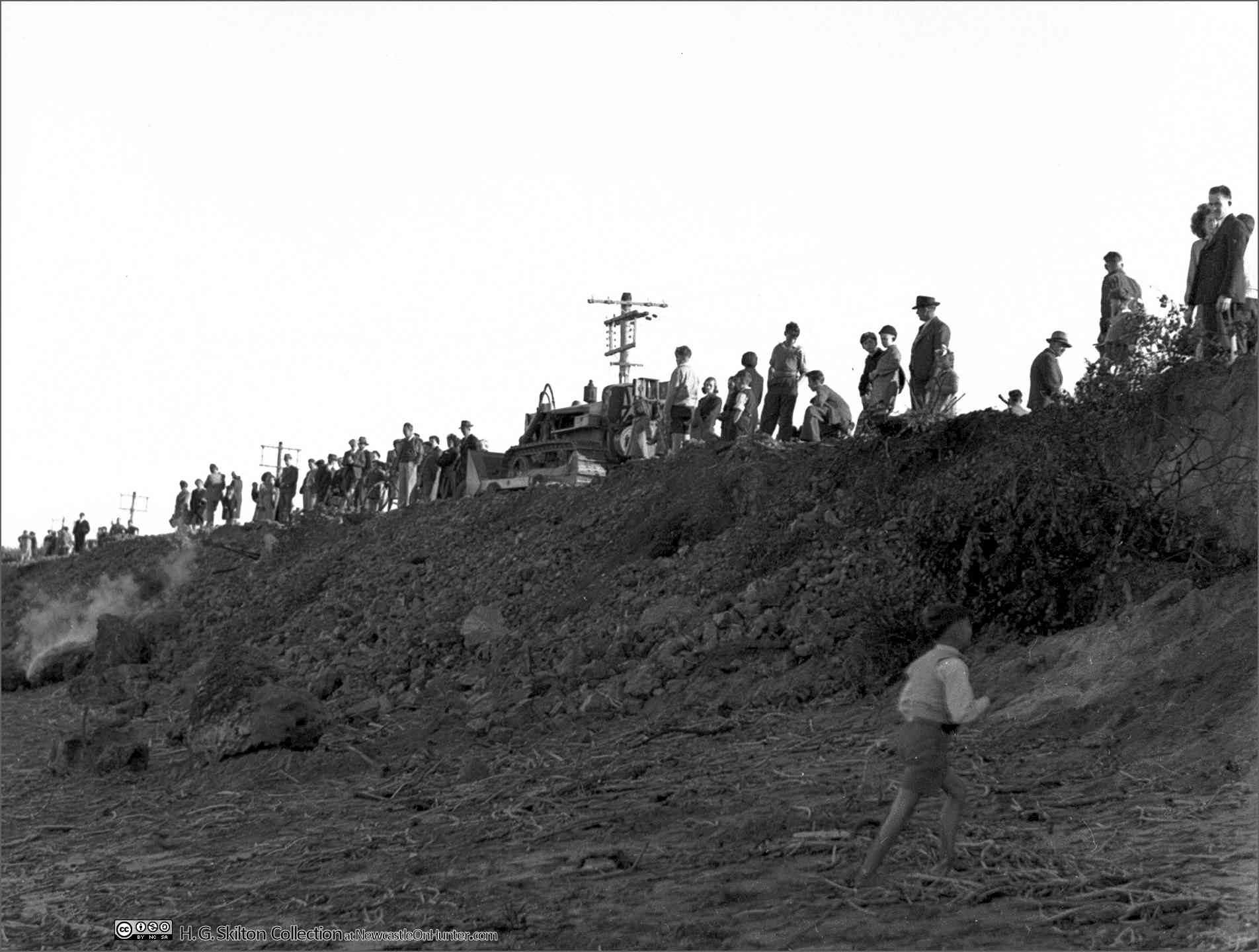
Late in the afternoon of Sunday, 20th June 1948, Henry Skilton joined the swarm of sightseers inspecting the damage to Stockton Beach wrought by the previous week’s heavy seas.
By some estimates, had removed 30 metres of foreshore, churned without trace into the bight.

Above ~ Crowds and a procession of cars inspect the aftermath of a winter
storm in 1948
At right ~ Henry Skilton's negatives envelope, showing
notes of the day

This recurring event keeps Stocktonians in dread that their beloved suburb is steadily dissolving, that one day it will be their home sliding down some small sandy cliff to be torn apart by storm surge.
Waves washed against a 6ft. high sand wall along the shore from the breakwater to the southern end of Mitchell-street. Parts of the bank fell in as each wave receded.
Tank traps prevented further erosion along Mitchell-street. Some of the pine trees planted around a memorial near the oval after the first World War are in danger.
Yesterday, the base of one was only a foot from the edge of the bank against which the waves were washing. Residents said the nearest tree was about 250 yards from the sea when planted.
~ Newcastle Morning Herald, Thursday, 17 June 1948
Henry found himself mingling with not only the curious like himself, but with locals seriously dismayed by a devastation that foreboded the eventual loss of their homes by an unrelenting, almost vengeful, Tasman Sea.
As best he could, with a visually ambiguous subject, a sinking afternoon sun, and a buffeting westerly, the scene was duly recorded, to illustrate 7 decades later this depressing tale of the slow-motion loss of a cherished suburb.
A story that has yet to reach a conclusion, whatever that might be.

Despite a century of research, committees, reports, accusations, and refutations, no solution is forthcoming, and no certainty about where it might end.
Except one disconcerting fact: the entire peninsula is but a large estuarine sand bank, and defending it is an impossible task.
Breakwaters break other things
In the days when Nobbys was called “Nobby Head” and the northern harbour
breakwater was but a collection of wrecked vessels on Oyster Bank, Stockton’s
fledgling township at the peninsula’s tip gained a small breakwater at Pirate
Point in 1872.

Stockton in 1880 was a small settlement on the southern tip of the peninsula. From the full map at UoN Living Histories
Intended to assist channel flow, perversely, waves “entered the harbour more freely, and made the water very disturbed..” due to the loss of wave trapping by the sand banks it covered.
Flooding and erosion was common on the flat and open shores where Pitt, Mitchell, and Stockton (now Fullerton) streets ran right up to harbour waters, now even more exposed to heavy seas and storm surge. The northern breakwater at Shipwreck Walk, completed in 1912, aimed to extend and narrow river flow further seaward, to scour sand and reduce dredging. But as a century of relentless coastline retreat warns, this might have been the death knell in advance for the future seaside village.
A report on Wednesday, 17 July, 1912, shows the complexity of managing storm swells off the bight, as at that time both northern and southern breakwaters were well advanced, yet still didn’t prevent havoc within the harbour.
AT STOCKTON FURTHER DAMAGE
The heavy seas which swept over the bar accentuated by the exceptionally high tides caused a heavy range on the Stockton side of the harbour, which has resulted in a considerable amount of damage being done to the foreshores. Portion of the northern breakwater, close to the spot where the Adolphe was wrecked, broke away, with the constant hammering of the seas, and quite a bite of the waIl had slipped.
The seas, sweeping around the southern breakwater with terrific force, and surging along the Stockton side, caused a great amount of fretting under the wharves. The constant wash has so undermined portions of the approaches, that holes several feet wide and of considerable depth have appeared. This is very apparent at Stockton ferry wharf.
The wave traps in the southern side of the northern breakwater have not suffered any damage, most of the trouble being done by the onward sweep into the harbour.
The yard of Messrs. P. Callen and Son was also flooded, and the approaches to the punt on the Stockton aide were washed away. The water came completely over the slip and covered It and the rollers with sand and silt.
The Seamen’s Mission was knee-deep in water, The water had surrounded the building.
On the northern side the tide invaded the shores for fully 40 feet inland, a circumstance, which is unprecedented.”

Viewed north ~ Fullerton Cove top centre, Hunter River veers west, Stockton Bight at right. Walsh Island, centre, and the western fringe of Stockton peninsula were infilled from ship ballasts and dredging to narrow the flow of the Hunter River in the fight against silting.
Tank Traps Under Fire
News of erosion was curiously absent from the newspapers until following the Second World War when the subject burst forth as a regular topic, eliciting a barrage of letters to the editor from several armchair experts.
From Nobbys southward to Redhead, comprising pocket beaches, coastal storm damage is generally limited to the loss of beach sand, with encroachment resisted by the rocky shores. The citizens accept that each time a storm stripped city beaches bare, the gentle persuasion of time, waves, and currents would dependably restore them.
And until Stockton peninsula became more fully built on during the 20th century, there were few susceptible householders to be panicked by the alarming advance of the seas that, they began to notice, absent the rocky defences of their southern cousins across the harbour, would take and never seem to give back.
Stockton was planned as a government town with streets set well back from the beach, up to 120 metres, a buffer that has almost gone.
During the war “tank traps” (giant concrete tetrahedrons) were placed on
coastal beaches to thwart or slow a feared Japanese invasion. These devices
inevitably inserted themselves into the erosion debate - not helped by their
amazing ability to disappear into the sandy beach in good times, then
ominously reappear as a reminder of human folly during bad times.

Tank traps exposed by loss of beach sand. They were originally placed atop the embankment well back from the beach. They didn’t move seaward – the shoreline moved inland.
In the 7 decades since, tank traps and their natural counterparts, boulders and suchlike, have played a major role in slowing essentially unstoppable coastline drift, mainly by absorbing the energy of storm surges. They also stabilise weakened banks and sand, often sinking into the sand and acting as natural rock formations.
On 22 June, 1944, the Acting City Engineer, one Mr. Rudd (no relation, we suspect) told the Newcastle Works Committee that sand goes and sand returns. Sadly, his reassurance has shown to be valid for any city beach except Stockton’s.
Mr. Rudd said that while further erosion might occur, it was just as likely it would cease and that the former sand bank would again, be built up. He said the cost of a sea wall, even if it was practicable, would be enormous, if not prohibitive.
The committee decided to make an inspection. Mr. Rudd recalled that a year ago extensive erosion had affected the whole waterfront from Merewether to Stockton. Since then, it had extended much farther and closer to Mitchell-street. Wave action had sent water up the sand bank to road level in many places. At one position water actually crossed the main street.
Mr. Rudd said tank-traps and the removal of sand from Stockton had been blamed for the advance of the ocean.
“This contention is erroneous," he declared. "Erosion began in very rough weather a year ago. Before then, the tetrahedrons were high and dry; but as the result of the erosion they were lowered many feet to what became part of the beach.”
Gradually sand covered most of the tetrahedrons, but they were uncovered during rough seas last March, and the additional erosion has had the effect of extending the beach 30 to 40 yards closer to Mitchell-street.”

In May of 1945, with commendable caution and prudence, the council decided that:
While the whole of this foreshore shall be kept under periodic- observation, it is recommended that no action be taken in the matter at present."
Desperate for someone to blame, residents again proxied the tank traps to accuse the military defence establishment, and by tenuous extension council for approving the traps. Or maybe the Japanese fleet somewhere in the Tasman might be fomenting bad weather to bury the tank traps.
City Engineer, Mr. Knott, told council that people living along Stockton foreshore feared that the sand drift ultimately would destroy their streets and homes.
Residents of Mitchell-street blame the concrete blocks placed as tank traps when an invasion was feared, but Mr. Knott doubts this. The blocks were placed on a high sand dune about 30 yards back from the edge. The positions were selected by the military authorities.
About two years ago the blocks were undermined by erosion during heavy southerly gales, and they dropped down to what is now the extension of the beach.
Mr. Knott reported that the blocks were covered by sand, with only the point of the reinforcement showing on a number of them. He said the erosion' appeared to be still extending and had reached a point about 30 yards back from the blocks.
“It is doubtful whether these blocks have any influence on the erosion, he said. "This feature commenced when the blocks were well above the limits of the wave action and, even now, when they are well covered the erosion continues. It may continue still further, while, on the contrary, it may cease at any time; or it is possible that the sand may bank up again.”
Mr Knott was quite good at hedging bets.
Alderman Soper wasn’t having a sand bar of it. Oblivious to the facts, he declared money was due from whomever, and the military had put Stockton’s beach at risk on the mere premise of defending the country. During a council brouhaha on 12 June about the Housing Commission’s plan to put their product on shifting sands, came his assertion:
Report on Responsibility
On the motion of Ald Soper, at Greater Newcastle Works Committee the Town Clerk (Mr. Wells) will prepare a report on land erosion at Stockton on any Government liability.
Ald. Soper said reports by the City Engineer and Parks Surveyor did not touch upon the tank traps on the beach, which had been responsible for the erosion. Placing the traps on the beach and levelling by the military for a road were the main cause of the trouble. The traps stopped the sand from banking up.
''The only thing we can do is to ask the Town Clerk to inquire into what claims we have for compensation and on whom we can make the claims,” said Ald. Soper.

"Irate, Inane, Astute" ~ Letters Flowed to the Editor
J.G. Collins accused children playing on the erosion line of causing the bight’s blight and suggested both closing Stockton Beach and appointing a patrolman to keep the little environmental vandals at bay, so to speak ~
Sir, I live in Mitchell-street, near the beach, and ever since the big gale in October, 1942, thousands of tons of the foreshores have been displaced, and large quantities of shrubbery torn out by children and others of maturer age who should know better.
It is a daily sight to see children, many of them well in their 'teens, sliding down the declivities, rooting out the hillocks, etc., and tumbling the sand and shrubbery down to the beach.
During this week's gale there were numbers of kiddies breaking down the small remaining walls of sand and the last barrier against the sea into the water.”
F. G. Nelmes (no relation?) had no interest in what caused erosion, just that council should immediately call an end to it ~
Sir,- We have been hearing a good deal of talk on the cause of the sea erosion at Stockton, but nothing is done. The cause of the erosion does not concern us so much as its effects.
The people along Mitchell street and North Stockton are only too well aware that the sea is rapidly approaching and threatening their homes, on every high tide. and the sooner the authorities cease talking and take action the better for all concerned.
Why should we have to wait for a calamity to occur, with probably great loss of. life, and our homes washed into the sea. before action is taken to stop the erosion?
Citizen of the handle “Ratepayer” had a short-term view of nature’s whittling away Earth’s land masses over the eons, and was impressed only by the evidence of his or her brief interlude in time - and those bloody tank traps’ effect upon one’s wellbeing. Besides, Ratepayer had a solid theory ~
Sir.- The sole cause of the erosion at Stockton is the line of tank traps along the foreshores.
The erosion has only started since these traps were placed there. Considering that they have only been there for about three years, and that in that period we have had only four heavy storms, the damage is enormous.
These traps were placed well above the waterline on the sandbanks which were 15 feet high. Their tremendous weight compressed the sand towards the beach, and at that time it did not need to sea to do the damage… (and so on). Further along the coast where the traps were not put down, the coastline has not been altered.”

Referring to the wave traps on the Pirate Point breakwall - not be confused with tank traps! – a regular correspondent on the subject, Port Hunter, asserted, with some prescience, and a touch of despair ~
Sir.- The important feature is that the water-line has not retreated, as witness the fact that a five and a half feet tide, with a slight sea,, actually reaches the embankment where the big seas finished.
For the following reason further encroachment at Stockton is certain. It is obvious that if the wave traps had not been built, the gradual obliteration of Stockton Peninsula would have been operating from the southern end.
The placing of the wave traps cannot alter the purpose of nature, and the sea, baulked along the direct route… is establishing a greater beach curvature to find a way round the back of these obstacles.”

Flagpole near Stockton Beach Pavilion
The Shoreline Advances, Still
Fast forward to June, 2016, and in The Herald we read yet again the distressed residents of Stockton are reporting the “worst erosion in memory” ~ which makes great reading but poor perspective, since memories are flaky and humans short-lived.
Nevertheless, the march of the shoreline gives weight to their claim, as it moves inexorably towards Fullerton Cove and never seems to “give back” what the previous storm took.
And, yet again, those bloody tanks traps have raised their pointy heads ~
WITH more rain forecast this weekend, Stockton Surf Lifesaving Club doesn’t have much more ground to give.
“The erosion of the beach is the worst it’s ever been,” club president Trevor Upton said.
“Our biggest fear is that if there’s another big swell, now we’ve got virgin ground with nothing in front of it.”
The storm that hit the Hunter hit two weekends ago gnawed 10 metres of dune from the beach and sent waves drumming on the doors of the white brick surf club. Fence palings littered the beach and copper pipes were left exposed and hissing.
Concrete World War II tank traps emerged in front of Lexie’s on the Beach cafe – where a wave crashed across the wooden deck – for the first time in decades.
“I’ve never seen the water get past those trees,” Lexie’s sous chef Paula Rika-Anderson said, referring to uprooted Banksia trunks on the sand below. “Now the trees are gone.”
But, Breakwaters…
The finger points squarely at harbour breakwaters. Why else didn’t the
peninsular disappear eons ago?
Associate Professor Ron Boyd, of Newcastle
University's School of Environmental and Life Sciences believes breakwaters
and a deep water channel disrupted wave patterns, preventing any new sand
being brought onto the beach.
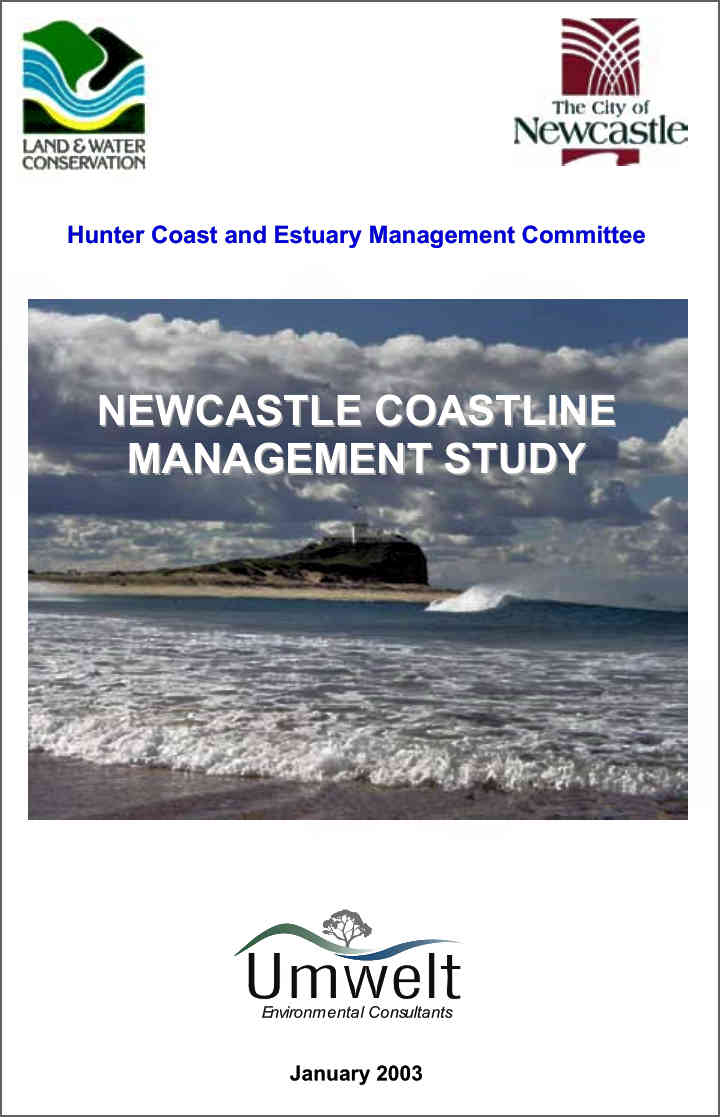 The
Newcastle Coastline Management Study* points out, unnervingly, that sea level since “the last thaw” 17,000 years
ago has ranged from 120 metres below the present level to 5 metres higher.
The
Newcastle Coastline Management Study* points out, unnervingly, that sea level since “the last thaw” 17,000 years
ago has ranged from 120 metres below the present level to 5 metres higher.
(*Link above opens the document pictured for download or viewing. PDF)
It cites conflicting predictions of Stockton shoreline’s probable future.
In
section 6.1.2.1. comes the disquieting read that erosion studies have not
quantified any coastal processes that result in the erosion or fluctuation of
Stockton Beach.

WBM Oceanics consider shoreline recession will prevail for 50 more years “at reducing rates.” But the Department of Land and Water Conservation (DLWC) reckons Stockton Beach “experiences large fluctuations but no long term recessionary trend of the shoreline is evident.”
NSW Public Works’ (PWD) Manly Hydraulics Lab ~
…identified large shoreline fluctuations at Stockton … may be attributable to major Hunter River floods.”
That possibility is obscured by the influence of breakwater constructions at the harbour entrance. And although it was accepted that both breakwater constructions have had a major influence on Stockton’s shoreline ~
“…it has not been concluded, either by PWD or WBM, that that the impacts of breakwater construction are completed.”
The breakwaters, according to historical views, have changed the shape of the southern end of Stockton Beach: the shoreline has progressed seaward along the breakwater and recessed just north of it. In part due to longshore currents (typical of longer open beaches), the situation is more complex than a north to south migration.
Based on a series of studies over 30 years, a 2012 Worley Parsons report proposed a conceptual model that the Mitchell Street seawall is at an unlucky null point, from which sand is taken both north and south, depending on dominant onshore weather.
 (*Link above opens the document pictured for download or viewing. PDF)
Sand is not being lost from Stockton Bight – it and its beach are a
closed system - except by wind from exosed areas.
The report suggests sand replenishment as the most effective and affordable remedy, and favours dredgings from the port as an excellent source. Short term, scrapings from further north along the beach would be effective.
Stockton, we wish you well.
Final word is by Letters to the Editor correspondent, a cruelly blunt Novocastrian C. G. Fisher, who on 10 May, 1946, gave no reassurance to Stocktonians by pointing out the obvious ~
The strange feature of this problem is that anyone should imagine that the erosion along this foreshore can be prevented.
Apparently the responsible authorities, who should have been aware of the impossibility of saving Stockton, will allow the residents to continue in their illusions for as long as possible.”

Post a Comment
Additional information, anecdotes, etc., or corrections are welcome.